Essential Deliverables for 3D Site Models from Aerial Data
When project teams commission aerial surveys, the final set of deliverables often determines how useful the data becomes. A clear understanding of what to expect and what to ask for can save weeks of rework. This is especially true when the goal is to build reliable 3D site models that the whole team can use for design, planning, or monitoring.
Capturing raw aerial data is only half the story. The other half is processing that data into formats that integrate with existing workflows, meet accuracy standards, and hold up under scrutiny. Without a checklist, teams risk missing critical outputs or receiving files that do not align with their project requirements.
Orthophoto Mosaics
An orthophoto mosaic is a geometrically corrected composite image that shows every point in its true geographic position. Unlike a simple photo stitch, an orthophoto removes perspective distortion and accounts for terrain relief. For 3D site models, this serves as the foundational layer. It provides a detailed, true-to-scale visual reference that can be draped over the elevation data. Check that the resolution is consistent across the entire site and that the georeferencing aligns with your coordinate system. Errors in this layer will propagate into every subsequent deliverable.
Point Clouds
A point cloud is the rawest form of 3D data. It consists of millions of individual points, each with X, Y, and Z coordinates. For construction and earthwork projects, the density of the point cloud matters. Sparse clouds miss subtle features like drainage channels or retaining walls. Look for density values that suit your application: a typical survey grade cloud might have hundreds of points per square meter. Also verify that the points are classified where possible, separating ground from vegetation or structures. This classification is what makes the data usable for volume calculations and surface modeling.
Digital Terrain and Surface Models
Digital Terrain Models (DTM) and Digital Surface Models (DSM) serve different purposes. A DTM represents the bare earth, stripping away trees, buildings, and other above-ground features. A DSM captures everything including vegetation and structures. Project teams need both for different tasks. For example, cut and fill estimates require a DTM to understand the natural ground surface. Overhead line clearance analysis, on the other hand, benefits from a DSM. Ensure the deliverables include both models in a common format such as GeoTIFF or ASCII raster. Check that the resolution matches your project scale; a 10 cm raster is fine for small sites, but larger areas may tolerate 30 cm or coarser.
Contour Lines and Breaklines
Contour lines are the classic way to represent elevation changes on a 2D plan. They are still essential for many engineering and permitting workflows. The contour interval should be chosen based on the site's slope and the project's tolerance. Flat sites may need intervals as small as 0.1 m, while steep terrain works with 0.5 m or 1 m intervals. Breaklines are linear features that define abrupt changes in slope, such as the edge of a road, a ditch, or a building foundation. Including breaklines in the deliverable makes the 3D site model more accurate for modeling water flow or structural loads. Ask for breaklines as separate vector files or as part of a surface definition file.
Volume Calculations and Cut-Fill Maps
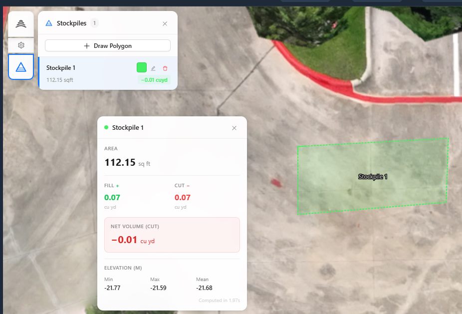
For any project involving earth movement, volume calculations are a primary deliverable. The contractor or engineer needs to know how much material must be removed or added. A good volume report includes net totals, separate cut and fill quantities, and a color-coded map showing where each occurs. The underlying surface models must match the site's current state. The National Drone Services drone data management platform can help teams compare multiple survey epochs to track changes over time. This comparison is critical when working with dynamic sites such as active construction zones or stockpile management areas. Volume reports should also specify the method used (grid, triangular, or cross-section) so the team understands the assumptions behind the numbers.
Geo-referenced Orthomosaics and Point Clouds
Geo-referencing is not optional. Every deliverable must align with a known coordinate system, ideally the same one used by the project's surveyor or local authority. Without proper geo-referencing, importing files into CAD or GIS becomes a manual alignment nightmare. Verify that the orthomosaics and point clouds carry embedded coordinate information in their headers or sidecar files. For point clouds, the LAS or LAZ format is widely supported and preserves georeferencing. For raster products, a world file or embedded projection is standard. The National Drone Services drone data management platform simplifies this by handling the processing and export in the required projection, reducing the chance of misalignment.
Metadata and Quality Reports
Raw files without metadata are difficult to trust. Each deliverable should come with a report that states the date of capture, the sensor used, the processing software version, and the estimated accuracy. Accuracy is typically expressed as root mean square error (RMSE) for horizontal and vertical components. Project teams should set a minimum acceptable RMSE before the survey begins, based on the intended use. For example, a 3D site model used for architectural design may need vertical accuracy within 3 cm, while a preliminary feasibility study can tolerate 10 cm. The quality report should also note any gaps or anomalies in the data, such as areas of heavy shadow that may affect the model's completeness.
File Formats and Delivery Structure
It pays to agree on file formats early. Common raster formats include GeoTIFF, JPEG2000, and MrSID. Vector formats include DXF, SHP, and GeoJSON. Point clouds are best delivered as LAS, LAZ, or E57. For 3D site models, consider requesting a format that retains texture and color, such as OBJ or COLLADA, if the team plans to use the model for visualization or public engagement. The delivery structure matters too. A well-organized folder hierarchy with separate subfolders for orthomosaics, point clouds, DTMs, DSMs, and reports makes it easy for everyone to find what they need. Avoid a single folder with dozens of unrelated files.
Reviewing Deliverables Before Acceptance
Before signing off, run a few checks. Load the orthomosaic into a GIS and compare it against known ground control points. Open the point cloud in a viewer and look for obvious errors like spikes or gaps. Check that the volume calculations match rough manual estimates. If something looks off, ask for clarification or reprocessing. Most providers will correct issues if flagged promptly. Having a checklist prevents surprises later in the project when fixing data problems costs more time and money.
Teams that invest time upfront in defining these deliverables get better 3D site models that integrate smoothly into their workflows. The result is fewer revisions, more reliable analysis, and a single source of truth for everyone from the surveyor to the project manager.
National Drone Services on social media
 Facebook